|
WATERSHED PROGRAMME
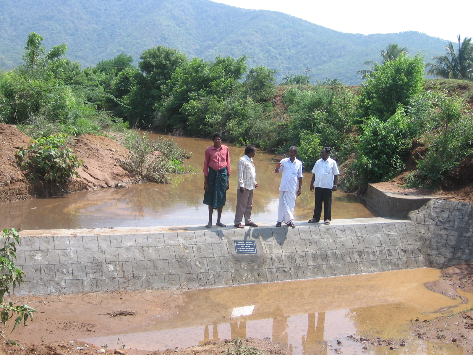
The area is located at Paramanandal Panchayat of chengam block of thiruvannamalai district it’s 5 Km from chengam town, the location of the Paramanandal village is surrounded by Eastern ghats of jawadhu hills and the bed of cheyyar river, the place selected for the wirk. The crops cultivated are paddy, groundnut, turmeric, sugarcane, horse gram and floriculture. The majority of the population belonging to schedule caste community, the landless people. Only 25% of the villagers own land and rest are landless.
The Eastern Ghats is covered with tropical scrub jungles which fringe that ghats, the local people depends solely on these jungles forest and hills for firewood grazing cattle and nature manure etc. These natural resources also provides livelihood for local poor during lean periods to a certain extent.
These lands had been badly affected by rains, which have caused large scale of soil erosion, and have sitted up the ponds, tank thus reducing water-holding capacity of the irrigation sources. This has resulted in acute water shortage, the irrigation sources have been grossly neglected and consequently the ground water level has gone down.
For reclaiming the tanks and ponds, it is necessary to avert deforestation encroachment on forest land and soil erosion by extensive treatment of these ponds which may help in harnessing the rainwater received during monsoon to the fullest extent possible Encroachment into ponds have to be remarked and defitting has to be done
Organization
The organization has conducted regular campaigns in and around Paramanandal village involving school and college students during the campaigns, processions were held with slogan, placards, songs, street play, skit and also exhibition in those surrounding villages.
The organization has also conducted two cycle rally around the hills 60 children have been involved in this programme. The organization has also conducted group discussion and celebrated World Environment Day periodically with eminent scholars and exhibition were conducted on the occasion with painting and drawing on the issue of ecology. The organization has invited a ecologist Shri. Ventachalam of ‘Save the Eastern Ghats’ for the campaign around the Jawadhu Hill side area. The organization has a close contact with Department of Forest, Agriculture and Education through programmes conducted by the organization
Problems to be identified in watershed areas
The notified area beneath of this slope the topsoil is eroded by 27-75% major soil is eroded, during rainy season. In that area there is no adequate watershed and proper drainage channels that leads to most if the vegetative cover removed and also the soil erosion is on increase every year leading to high fertile stop soil erosion. During rainy season the rainwater cannot be harvested because of poor watershed and poor drainage channels. This factor leads to poor infiltration rate.
The water scarcity is very high in summer days, people struggle even for drinking water, the water table go below every year, it may range of around 60-100mt from upper ground. In that area even though water scarcity, the farmers involve in cultivation of paddy, turmeric, groundnut , floriculture and sugarcane etc. which are high water requirement crops. This leads to poor output and low economic yield. In some part pig, cattle, and sheep grazing which also severely damages the cultivated crops affect farmer’s fields.
How to tackle this problem
· In that area the field are plain in nature which leads to poor infiltration rate and also the run off is very high, hence the field require farm bunds Deep ploughing the field by using disc plough which increase the percolation
· Maintain the vegetative covered by control the animal population
· Use low water consumption crops like pulses and fruit trees
· Effective use of groundwater by using sprinkler and drip irrigation system
· Construction of watershed, shunken pond, drainage channels etc
· The organization will create awareness among the farmers and form a farmer club and make them involve in the programme. Soil
The areas contain sandy loamy soil in nature with ph range of 6.5-7.5. In that area the soil depth ranges from 45-90cm some extent up to 1.25m. The soil having less water holding capacity moderately plasticity and stickiness which having swelling capacity. The water infiltration rate (downward and lateral movement) is very rapid, but very slow in sloppy areas. The bulk density of the soil is between 1.3-1.5mg m-3, the soil is highly suitable for cultivation of leguminous crop like groundnut, pigeon pea, cowpea and maize sorghum and tree crops like mango, sapota, teak and neem etc.
IMPLEMENTATION
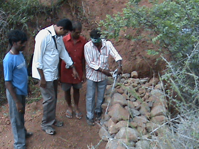
This watershed development programme is supported by NABARD the organisation is in the Capacity Building Phase and it has done soil and water conservation measure in the paramanandal village for 1040 ha the people participation by the villager has a great support and village watershed committee play a vital role in implementing the work which give work for the villagers most of the men migrant workers have stoped to migrate and started to work in their villages.
 
|